A visit to the Amazon floods and droughts in the last century
25th March 2021 | Duration of reading: 7 min
By Sly Wongchuig
The Amazon has immense natural and cultural wealth. It is the largest repository of biodiversity in the world with more than 10% of all plant and animal species on Earth. The Amazon offers multiple environmental services to each of its nine countries and to the world, such as a critical role in global water, energy, and carbon cycles. The Amazon river exports 20% of the river waters that are transported to the oceans across the globe. The forest recycles water to the atmosphere, and winds transport this moisture through rain to regions outside the basin. Ongoing environmental changes, such as climate change, deforestation, and fires, are profoundly impacting the biodiversity as well as the water cycle of this unique ecosystem. For more information check this link by BBC Brazil.

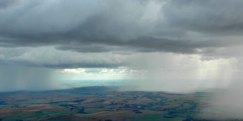
A rainfall event in the Rio Negro, Brazil. Photo by Sly Wongchuig.
One way to evaluate these impacts is through the use of extensive and consistent hydro-climatic records that allow, for example, the characterization of extreme hydrological events such as droughts or floods that have occurred in the past, the generation of hydrological forecasts (for example, river flow and water level) for the coming days or weeks as well as future projections for the coming years or decades. This information is also of great importance for adequate water resources planning by decision makers.

The 2014 flood event in the Madeira river in the city of Porto Velho. Source: Adalberto Marques/ Integração Nacional.
Some characteristics of Amazonia such as its large extension and complicated accessibility in many parts make it difficult to implement and maintain a ground monitoring network with a density adequate for the aforementioned studies. One way to redistribute this information spatially is through the use of hydrological models.
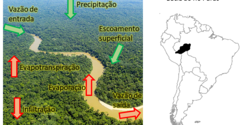
Hydrological models aim to represent each process of the water cycle through mathematical equations, such as precipitation, water interception by vegetation, water infiltration into the soil, runoff routing to rivers, and its propagation through them.
By using hydrological modeling tools with existing hydro-climatic observations in Amazonia, it is possible to generate an improved record both in time and space of the water cycle variables. In the study “Hydrologic Reanalysis throughout the 20th Century: A Case Study of Amazonia” (access the article here), these records are called hydrologic reanalysis. In this study we were able to generate a consistent record of streamflow and water level series for virtually the entire drainage network of the Amazon basin from the early 1900s to 2010.
Some results of these records are shown in the animations below in a spatially distributed manner on the map. The colors in blue and red represent the impact of the flood and drought event, respectively, and the intensity of the event is represented by the intensity in the color. For example, it can be seen that the 2010 drought was quite intense (dark red) and extensive in the central region (affecting the flow of the Amazon River and its major tributaries). The circles represent information from in situ observations. Additionally, the time series in the figures show information for the Negro river at the Manaus station, indicating the impact of the event in this region in relation to its historical average. Thus, with the support of the hydrologic reanalyses, we can not only verify the historical flood (e.g. 1999, 2009) and drought (e.g. 2005, 2010) years that were identified in regions with in situ records, but we can also identify, with a certain degree of confidence, these events in places where no historical records were available.

Spatial impact of floods in the Amazon rivers shown for the last 20 years of record. The time series in the bottom shows the water level variability in the Negro River at the Manaus station.

Spatial impact of droughts on the rivers of the Amazon shown for the last 20 years of record. The time series in the bottom shows water level variability in the Negro River at the Manaus station.
Finally, this research aimed to spatialize hydrological information in order to obtain records in various regions of the Amazon that do not have in situ stations. This allows the democratization of valuable information that would directly benefit the Amazonian populations. The database of historical record of flow series generated in this work, whose results were validated and published in a scientific article, was named HRXX (hydrological reanalysis of the 20th century) and is freely accessible (check the database here).
Science is done collaboratively
The results presented in this text are presented in the article "Hydrological reanalysis across the 20th century: A case study of the Amazon Basin", published in the Journal of Hydrology in 2019 (see list of materials below). These results were part of the research conducted by Sly Wongchuig during his PhD course at the Postgraduate Program in Water Resources and Environmental Sanitation at the Federal University of Rio Grande do Sul (PPGRHSA-UFRGS), under the supervision of Professor Rodrigo Paiva, within the Large Scale Hydrology Research Group from UFRGS. This research was supported by CAPES grant.
Want to know more? Access the links below!
Wongchuig, S.C., de Paiva, R.C.D., Siqueira, V., Collischonn, W., 2019. Hydrological reanalysis across the 20th century: a case study of the Amazon Basin. J. Hydrol. 570, 755–773. (Link)
Wongchuig, S.C., Paiva, R.C.D., Espinoza, J.C., Collischonn, W., 2017. Multi-decadal hydrological retrospective: case study of Amazon floods and droughts. J. Hydrol. 549, 667–684. (Link)

Sly Wongchuig is an agricultural engineer graduated from the National Agricultural University la Molina (UNALM, Peru), master in Water Resources in Agricultural Systems (UFLA), PhD in Water Resources and Environmental Sanitation (UFRGS). He is currently a postdoctoral researcher at the Institute of Geosciences and Environment (IGE) at the University of Grenoble Alpes (UGA, France). See more on the Lattes and at ResearchGate.

